Unlock the Power of Landchecker APIs
Reliable. Accurate. National.

Landchecker delivers comprehensive property data you can count on — covering every corner of Australia, updated daily from thousands of trusted providers and authorities. Landchecker’s integrations update in realtime, providing a unique level of accuracy across the Nation.

Our data sets are thoroughly collected, analysed, curated and enriched, so you can move forward with confidence. No fragmented sources. No outdated records. No second-guessing.

Whether you're building workflows, powering applications, or making time-sensitive decisions, Landchecker gives you the insight-driven foundation your business needs — accessible via

  • JSON API
  • Tiles API
  • Documents, Reports & Imagery API
  • Bulk Data (via Landchecker Data Vault)

Ready to see what's possible? Contact us to schedule a personalised consultation.

Valuation — Less Admin, More Analysis

Every valuation job starts the same way: searching for property data across multiple sources, manually entering details, cross-referencing records. It's repetitive, time-consuming, and prone to error. Landchecker automates that groundwork — pulling verified address details, land size, zoning, frontage, orientation and permit history the moment a job is registered. Your team spends less time on data entry and more time on what actually drives value: analysis and judgement.

Agents & Developers — Richer Data, Smarter Systems

Your CRM, your portals, your internal tools — they're only as powerful as the data inside them. Landchecker integrates directly into your existing systems, automatically enriching property records with accurate, up-to-date information the moment you need it. From lot and plan numbers to zoning classifications and permit status, your team gets a complete picture without switching platforms or chasing down records manually.
Architects — From Brief to Design, Faster

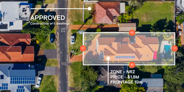
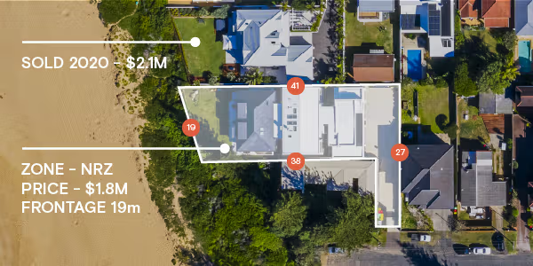
Before a single line is drawn, architects need to understand the site. Zoning constraints, land dimensions, frontage, orientation — getting this information manually can eat into valuable project time. Landchecker puts verified site data at your fingertips from the outset, so your team can move from client brief to concept faster, with confidence that the parameters you're designing to are accurate and current.

Builders — Faster Due Diligence, Fewer Surprises

Before committing to a site, builders need answers fast. What's the zoning? What permits have already been lodged or approved? What are the exact land dimensions? Chasing this information across councils, title offices and planning portals takes time your pipeline can't afford. Landchecker consolidates verified site data into a single, reliable source — so your team can assess feasibility, flag constraints and move through due diligence with confidence, before time and money are on the line.

Accurate, reliable, high-quality data, nationally

Landchecker provides accurate, reliable, high-quality data, nationally. We receive and process data from our providers daily. Gain a competitive edge with no more fragmented, outdated, inaccurate data. Our comprehensive data sets are thoroughly collected, analysed, curated and enriched to provide you with the data you need to make informed insight-driven decisions. Access our data via the Landchecker platform or reach out if you need a bespoke solution or to access our data within you application via an integration. Our data solutions include JSON API, Tiles API and downloads via the Landchecker Data Vault. To find out more about our data solutions, contact us to schedule a personalised consultation and discover how our data can transform your business.
DATASET
LGA COVERAGE %
POPULATION COVERAGE %
UPDATED
Address
100%
100%
DAILY
Parcel / Property Identifier
100%
100%
Daily
Land Size
100%
100%
Daily
Frontage
100%
100%
monthly
Orientation
100%
100%
Monthly
Zone
100%
100%
Weekly
Overlays / Layers
100%
100%
Weekly
Hazards: Flood, Bushfire etc.
100%
100%
Weekly
Permits / Development Applications
97.5%
99%
daily
Easements
100%
100%
1st & 3rd Monday of the month
High Resolution Imagery
-
~95%*
4 times per year
DATASET
LGA COVERAGE %
POPULATION COVERAGE %
UPDATED
Address
100%
100%
DAILY
Parcel / Property Identifier
100%
100%
Daily
Land Size
100%
100%
Daily
Frontage
100%
100%
monthly
Orientation
100%
100%
Monthly
Zone
100%
100%
Weekly
Overlays / Layers
100%
100%
Weekly
Planning Layers: HOB, FSR, LSZ, TOD
100%
100%
Weekly
Hazards: Flood, Bushfire etc.
100%
100%
Weekly
Permits / Development Applications
95.4%
99.6%
daily
Easements
100%
100%
1st & 3rd Monday of the month
High Resolution Imagery
-
~95%*
4 times per year
DATASET
LGA COVERAGE %
POPULATION COVERAGE %
UPDATED
Address
100%
100%
Weekly
Parcel / Property Identifier
100%
100%
Weekly
Land Size
100%
100%
Weekly
Frontage
100%
100%
monthly
Orientation
100%
100%
Monthly
Zone
30%
94%
Weekly
Overlays / Layers
60%
98%
monthly
Hazards: Flood, Bushfire etc.
60%
98%
Weekly
Permits / Development Applications
97.5%
99%
daily
Easements
100%
100%
1st & 3rd Monday of the month
High Resolution Imagery
-
~95%*
4 times per year
DATASET
LGA COVERAGE %
POPULATION COVERAGE %
UPDATED
Address
100%
100%
Weekly
Parcel / Property Identifier
100%
100%
Weekly
Land Size
100%
100%
Weekly
Frontage
100%
100%
monthly
Orientation
100%
100%
Monthly
Zone
100%
100%
Weekly
Overlays
100%
100%
Weekly
Hazards: Flood, Bushfire etc.
100%
100%
Weekly
Permits / Development Applications
100%
100%
daily
Easements
100%
100%
1st & 3rd Monday of the month
High Resolution Imagery
-
~95%*
4 times per year
DATASET
LGA COVERAGE %
POPULATION COVERAGE %
UPDATED
Address
100%
100%
Weekly
Parcel / Property Identifier
100%
100%
Weekly
Land Size
100%
100%
Weekly
Frontage
100%
100%
monthly
Orientation
100%
100%
Monthly
Zone
100%
100%
Weekly
Overlays
100%
100%
Weekly
Hazards: Flood, Bushfire etc.
100%
100%
Weekly
Permits / Development Applications
100%
100%
daily
Easements
100%
100%
1st & 3rd Monday of the month
High Resolution Imagery
-
~95%*
4 times per year
DATASET
LGA COVERAGE %
POPULATION COVERAGE %
UPDATED
Address
100%
100%
Weekly
Parcel / Property Identifier
100%
100%
Weekly
Land Size
100%
100%
Weekly
Frontage
100%
100%
monthly
Orientation
100%
100%
Monthly
Zone
100%
100%
Weekly
Overlays / Layers
100%
100%
Weekly
Hazards: Flood, Bushfire etc.
100%
100%
Weekly
Permits / Development Applications
83%
93%
daily
Easements
100%
100%
1st & 3rd Monday of the month
High Resolution Imagery
-
~95%*
4 times per year
DATASET
LGA COVERAGE %
POPULATION COVERAGE %
UPDATED
Address
100%
100%
Weekly
Parcel / Property Identifier
100%
100%
Weekly
Land Size
100%
100%
Weekly
Frontage
100%
100%
monthly
Orientation
100%
100%
Monthly
Zone
100%
100%
Weekly
Permits / Development Applications
17%
82%
daily
Easements
100%
100%
1st & 3rd Monday of the month
High Resolution Imagery
-
~95%*
4 times per year
DATASET
LGA COVERAGE %
POPULATION COVERAGE %
UPDATED
Address
100%
100%
Monthly
Parcel / Property Identifier
100%
100%
Monthly
Land Size
100%
100%
Monthly
Zone
100%
100%
Monthly
Testimonials

Trusted by thousands of businesses every day

"Having access to all this property information in one place is invaluable, from sales data, to planning information and permits. The Landchecker map is very easy to use."

Dane Carruthers
Manager, Rating & Taxation Valuations - CBRE

"Clients expect the advice to come immediately so they can make informed decisions on whatever it is they're doing, whether it is an acquisition or development applications or VCAT, Landchecker is that one-stop-shop; a tool that we could use to provide advice we could then give to our clients in a timely fashion."

Simon Martin
Director - Ratio

“Landchecker is the most used and popular online tool for KordaMentha’s real estate team. Its intuitive platform simplifies complex property research, enabling our team to quickly retrieve essential information such as land size, zones and overlays, planning information, and sales history."

Tom Korda
Director, Real Estate - KordaMentha

"Landchecker has been a gamechanger for InForm - not only in the way in which we are able to gather all accurate information on parcels of land, but also in the way in which we service our clients."

Nigel Garson
Head of Project Management - InForm

"Landchecker is essential for our business for evaluating development opportunities by offering detailed property insights, High-Resolution Imagery, and zoning data to save time and enable confident decisions."

Warren Millar
Business Development Manager - Fairhaven Homes

"Landchecker has provided significant support to our due diligence process, providing efficient searching solution and quick access to key planning data and high-resolution imagery. It’s an essential tool improving the efficiency of our opportunity assessment."

Roy Hu
Senior Analyst - Castle Group

Want to make faster, insight-driven property decisions? Join Landchecker for free today.