Landchecker For Legal Professionals
Legal professionals use Landchecker as their go-to source for all things property. From completing contract reviews to de-risking the settlement process to assessing a subject property for illegal structures, the Landchecker platform aggregates the data required in one easy-to-use map-view experience. Whether gaining insights or conducting due diligence, savvy legal professionals use Landchecker to make the best property decisions, faster.
“Our team of conveyancers uses Landchecker every day, in detail. We reference property data sourced from Landchecker in our team meetings, and rely on it in our contract reviews for both sales and purchases. Landchecker enables us to check contract details against accurate data sets and high-res images of the subject property, so that we feel confident advising our clients with the most comprehensive information throughout their settlement process.”
Mary Commisso, Director, Indeed convey
High-Resolution Aerial Imagery
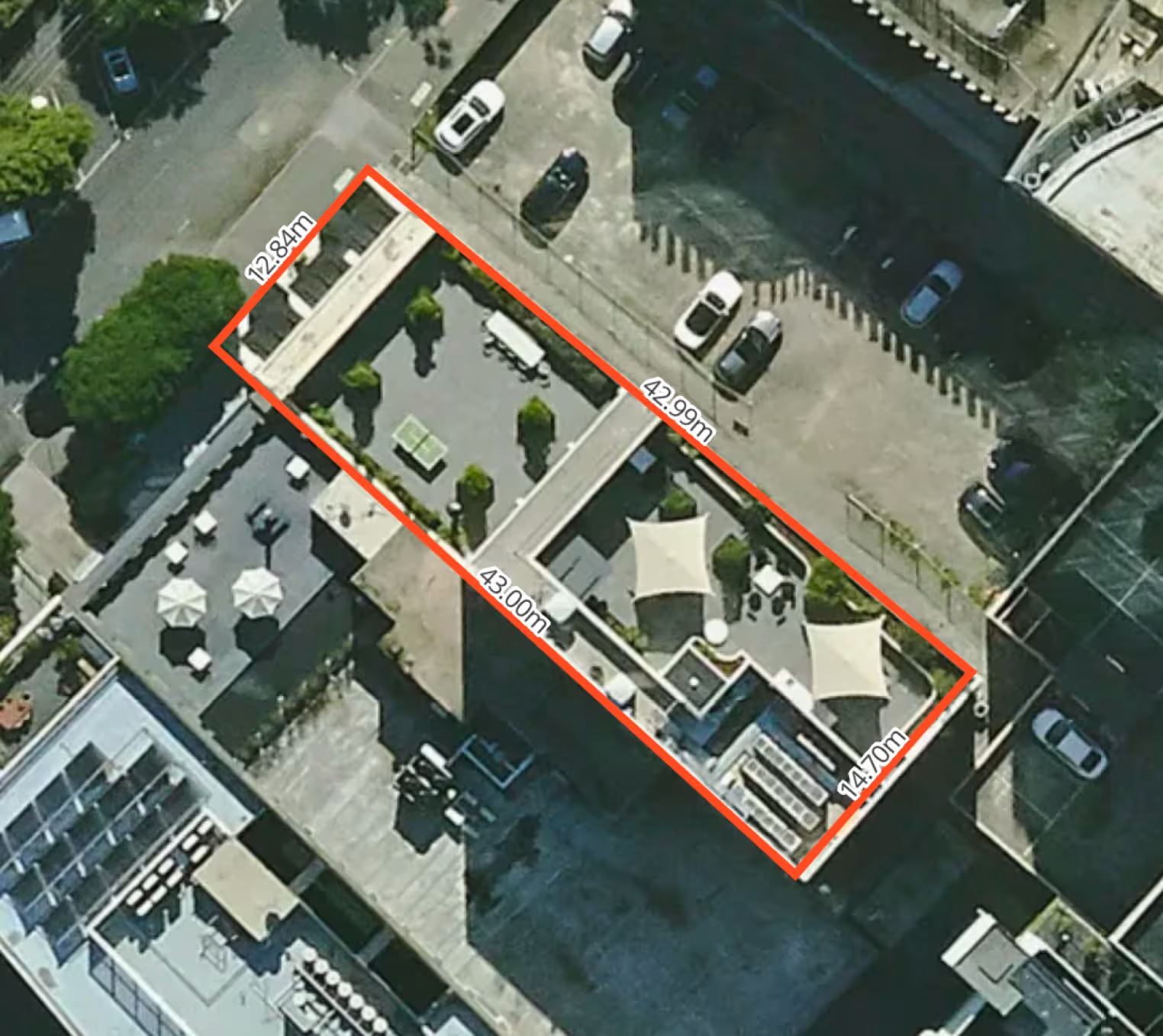
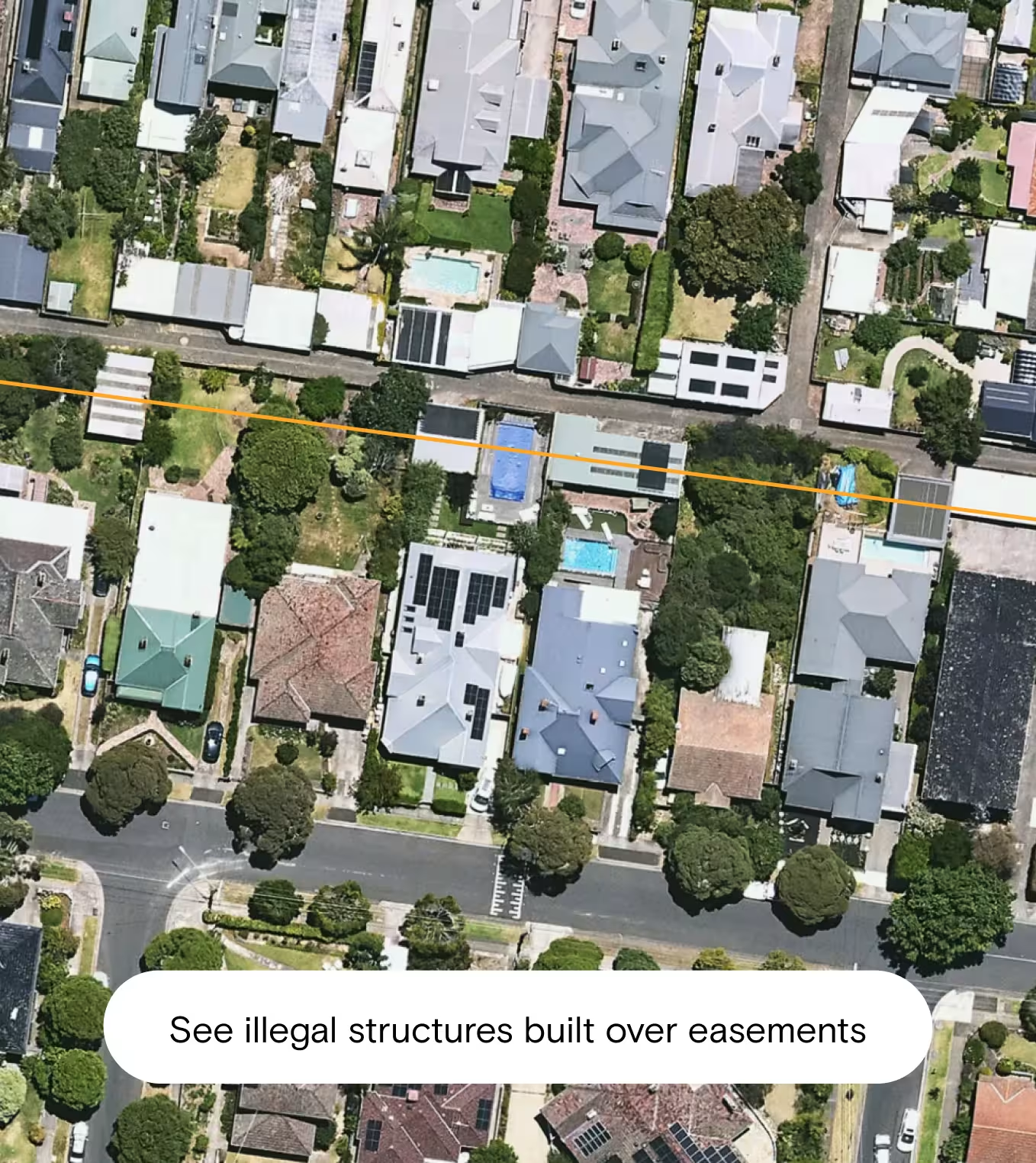
Utilise high-resolution aerial imagery to gain a visual of properties of interest. By clicking on any property in Metro areas, you can benefit from the clearest and most up-to-date aerial imagery, captured quarterly by Aerometrex. Whether you are assessing a subject property for illegal structures for a client's potential purchase or determining a property’s condition vs what’s been approved via permits/DAs, you can rely on high-resolution aerial imagery to give you that initial snapshot, without having to leave your desk.
Historical Imagery:
Appreciate a property in context by tracking back over the past two decades in metro areas and up to one decade in rural areas to view environmental or developmental changes. By comparing historical imagery to the approved permits/DAs within Landchecker platform you can confident to inform your clients with the most accurate and up to date information.
Free Property Report - Why through Landchecker?
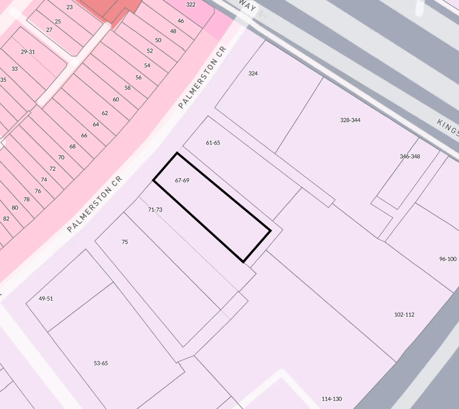
When a property report is your staple for basic knowledge acquisition on any given property, you’ll want to get your hands on this free document as quickly as possible. Through Landchecker, you can access a Free Property Report within seconds, simply by clicking on (or searching the address of) your subject property on the map, then tapping “View Report” in the side-panel. The ready, easy-to-read summary of key data includes: basic property details (including property attributes and sales history), basic council and locality information, planning zones, boundaries and overlays, even burglary statistics and bushfire area checks. The advantage of going through Landchecker isn’t just the speed and ease of access: the map-view also enables you to visualise this data in context, complete with the relevant layers (zones and overlays).
Why pay for Premium?
Legal Professionals need to relay essential data on a subject property to their team and clients in a timely manner, and with effortless professionalism. The Premium Property Report gives you that professional edge- you can download this as easily as the free report, in tact with your company logo for ready distribution to stakeholders.
In seconds you can generate the report to share with detailed property information with your clients building authority, trust ensuring you win more business and deliver exceptional customer service to your clients.
And it’s not just the slick presentation- you’re paying for more comprehensive data sets that include:
- Planning Permit/Development Application History
- Planning Permits/Development Application (approved, rejected and pending) in the vicinity
- Planning Scheme Amendments (recent and proposed)
All this data is distilled from the Landchecker map-view into one report, helping you give informed advice and provide a value add to your customers. There’s a few good reasons why professionals opt for the premium experience through Landchecker.
Why you need to conduct Title and Document Searches:
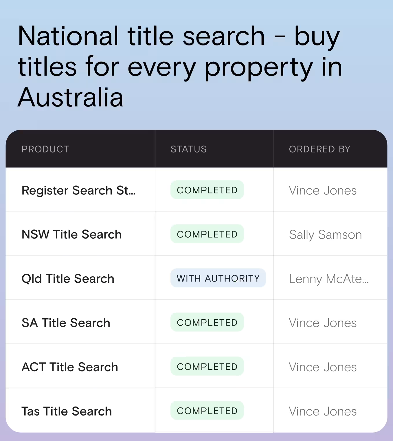
Title and Document Searches are essential for every property settlement. It is in your hands to ensure you’re across the fundamental legalities of your property of interest, so you’re best accessing these documents to cover yourself before you proceed.
Why through Landchecker:
Conducting a competitively priced Document Search is a mere extension of the Landchecker experience - either by selecting your subject property on the map, or by entering its details (address, council number, crown description, lot/plan, SPI or volume/folio) into a Document Search, you can quickly and easily purchase your selected products, competitively priced, without leaving the app. Better still, you can allow others in your team to view your purchased documents so you’re all kept abreast of property legalities.
Local Planning Permits/Development Applications - why you need to know
When advising customers looking to purchase you need to understand what structures have been legally built on the subject property, you’ll want to keep up-to-date with local planning permits/development applications (DA’s) and their status. Council-approved developments also present opportunity and possibility for, assessing, designing or building within the same planning regulations, this information is a nice value add for you customers who might be looking to build or renovate their next purchase.
How you can use Permit/DA Filtering
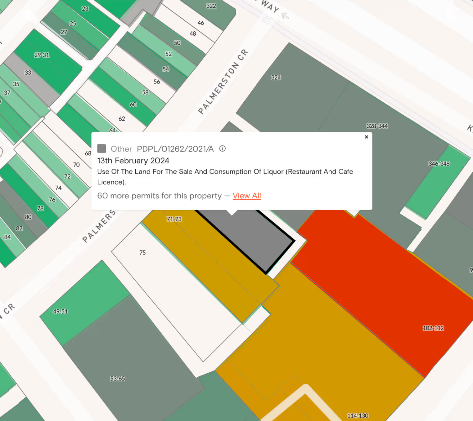
In one simple search through Landchecker, you can instantly see approved (green), pending (yellow) and rejected (red) permits on your map-view using the traffic-light system of filtering. Apply a keyword (eg. subdivision) to locate relevant permits/DAs to your project or property pursuit. Apply dates to your permit search too if needed.
Comparing the Permits and DAs to what you see in the historical imagery empowers you to inform your clients of all the facts ensuring any additional building has been permitted.