Data On Demand
Unlock the Power of Landchecker Data
Introducing Landchecker’s Premium Data Solutions. Take your business to the next level.
Landchecker provides accurate, reliable, high-quality data, nationally. We receive and process data from our providers daily. Gain a competitive edge with our premium data solutions. No more fragmented, outdated, inaccurate data. Our comprehensive data sets are thoroughly collected, analysed, and curated to provide you with the data you need to enhance your products and make informed insight-driven decisions.
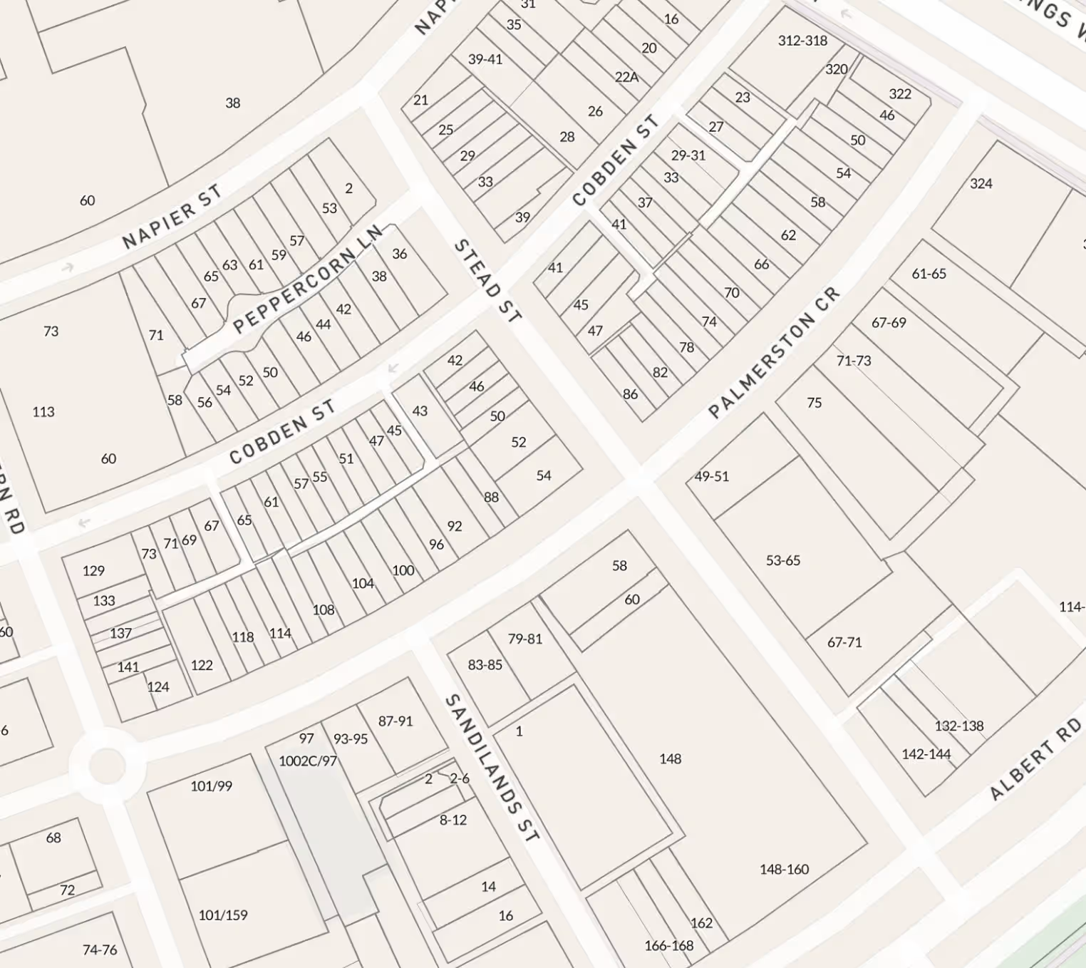
Cadastre and addresses
Cadastre, interchangeable with Parcel
Cadastral area boundary is a line layer that is spatially represented, consisting of data representing legal land parcels in every state and territory.
Address
An address is a street number, when used in combination with other address components such as the road name and locality. New and amended addresses are updated daily and weekly.
Road Casings
Road casings contain data related to roads and their boundaries within the cadastre system. This includes detailed information such as precise delineations of the boundaries of roads and streets within the cadastre system, road classifications such as highways, local roads, residential streets, road alignments including geospatial data representing the centreline of roads and road network connectivity indicating how roads are interconnected within the cadastre, including intersections, junctions, and access points.
Administrative Boundary
Administrative boundary data contains the spatial authoritative boundary information in every state and territory, covering administrative areas and aligned with the State’s cadastre. It includes local governments, local government wards, localities (suburbs), townsites, land districts, port authorities, marine parks and reserves, infrastructure corridors, water control areas, state forests, Native Title claims, and state electoral districts and regions.
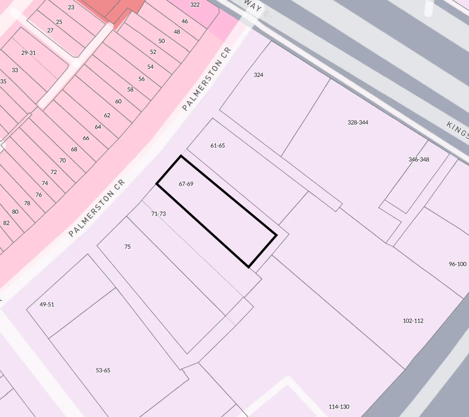
Planning Controls
Property Zones
Zones are designated areas within a municipality or jurisdiction that are subject to specific land use regulations and restrictions. These regulations dictate how land and buildings within the zone can be used, developed, and occupied. Zoning helps to organize and control the development of urban and rural areas, ensuring that land is used in a manner that is compatible with its surrounding environment and neighbouring properties. Property zones typically encompass various categories such as residential, commercial, industrial, agricultural, and mixed-use zones.
Property Overlays, interchangeable with regulatory overlays
Overlays are layers of zoning regulations that are applied to specific areas within a municipality or jurisdiction. Unlike traditional zoning districts that cover broad categories of land use, overlays are designed to address specific concerns or objectives for certain geographic areas. Property overlays are typically used to impose additional requirements or restrictions on top of the existing zoning regulations. They may be implemented to achieve various goals such as:
1. Preservation of historic or cultural resources;
2. Environmental protection;
3. Design standards;
4. Affordable housing;
5. Transit-oriented development; and many others.
Premium Property Report
Property Report
Landchecker’s Premium Property Report gives you a comprehensive summary of your subject property. It provides you with information about planning permits and planning schemes affecting your subject property. The report can be white labeled with your company’s information.
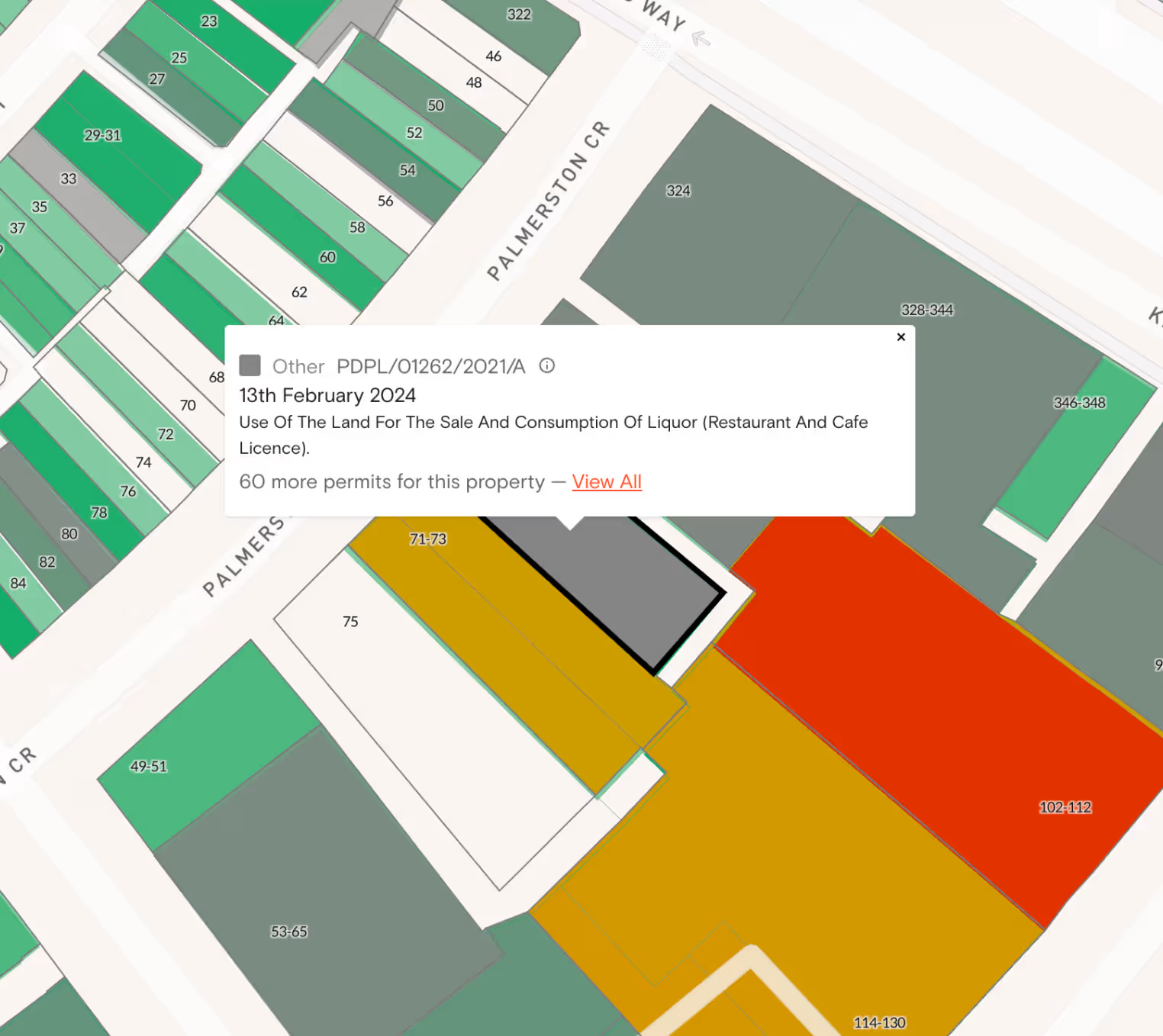
Permits and Development Applications (“DAs”)
Permits and DAs
Our data solutions provide you with access to permits/DAs on a property that are approved, pending and rejected as well as the description in real time, directly from the council authority that grant permission to undertake certain activities or projects.
Reverse Geocoding
Longitude/Latitude Geocoding
Landchecker provides the ability to convert geographic coordinates (longitude and latitude) into an address or location description.
Documents: Titles, Copy of Plans and Property Certificates
Documents such as Titles, Copy of Plans and Property Certificates
Landchecker is an information broker in Victoria and NSW. As such, documents such as Titles, Copy of Plans, Dealings, amongst others are available in these jurisdictions with additional documents such as Property Certificates available in Victoria.
Why Choose Our Data Solutions?
1. Extensive Coverage: We offer full, comprehensive, national coverage. Our interactive platform has been in market for over 5 years. During this time, we have established partnerships with the state and territory governments and industry innovators including, Aerometrex for high resolution imagery. This tenure has allowed us to create bonds which allows us to deliver you rich, consistent, and consolidated data. This means you can access data for greater impact.
2. Fast and Accurate: We receive and process data from our providers daily. This means you have access to more properties and addresses, more frequently, than any competitor. Our data is reviewed through our quality control processes to ensure the highest level of accuracy. No more unreliable sources and outdated information. You can trust our data to support and fuel your business needs.
3. Customised Solutions: We know that every business is unique. That's why our data solutions are fully customisable to fit your specific needs. Whether you require APIs, shape files, WMTS/WMS, periodic reports, or specialised analytics, our dedicated team will work diligently with you to design a solution that aligns with your business needs.
4. Data Security: We prioritise data privacy and security. As an integrated information broker, our robust infrastructure ensures that any sensitive information always remains protected. Our data is handled with the utmost confidentiality and complies with the highest industry standards.
5. Dedicated Support: We are not only a data provider, we are your data partner. We will support you through your implementation projects including assisting with integration. Our dedicated Customer Success team is here to assist you with any queries, technical issues, or data-related challenge
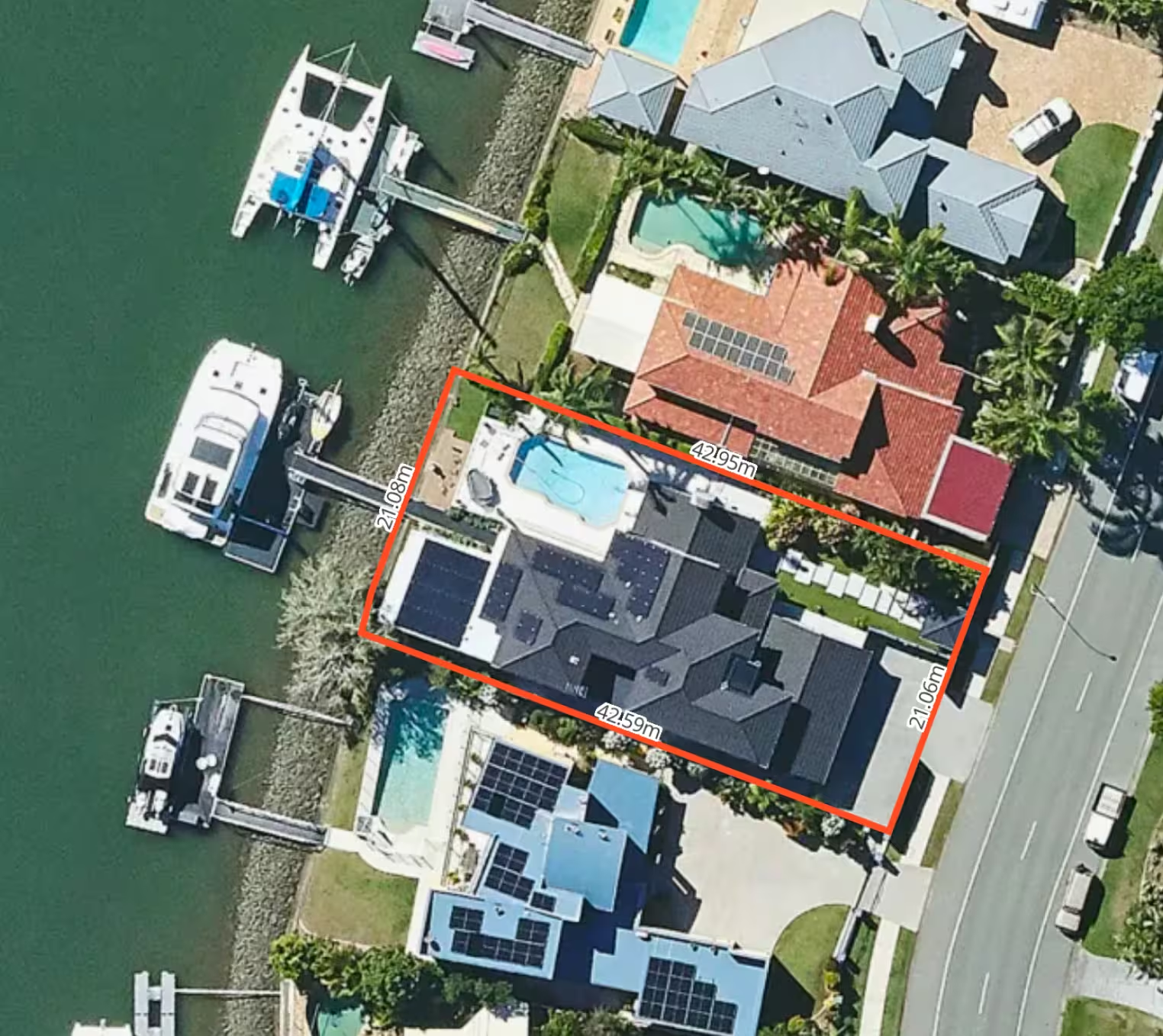
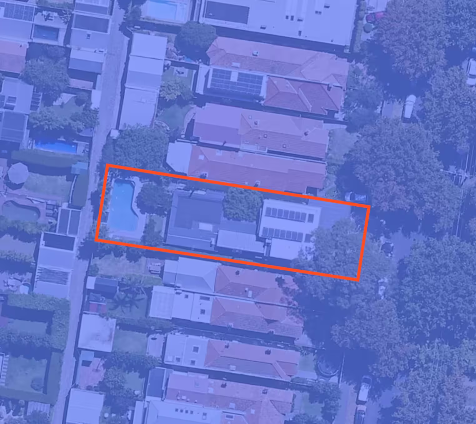
Landchecker Data Vault in detail
SFTP
Filter data by geographical area and select your chosen dataset to download. Data is available as a shape file. Datasets available in this format include cadastre, addresses, administrative boundaries, zones and overlays with more to come.
Landchecker API
Search a property to receive associated zone, overlay or permit information. Premium property reports are also available in PDF format via the Landchecker API and contain the following data; Lot/plan number, site dimensions, zones, overlays/other planning layers, heritage, flood, bushfire, topography, easements as well as permits/DAs on the property and nearby permits.
Tile Server
Access the Landchecker tile server to load the Cadastre and Addresses and the Planning Control products including data such as cadastre (parcel), administrative boundaries, addresses and road casings, zones, overlays, frontage, orientation and land size.
Don't let your competitors gain an edge while you use outdated, inaccurate, data. Landchecker’s premium data solutions can drive growth to your business. Let us empower you to make data-driven decisions that resonate with your customers.
To find out more about our data solutions, contact us to schedule a personalised consultation and discover how our data can transform your business.



Trusted by thousands of businesses every day
"Having access to all this property information in one place is invaluable, from sales data, to planning information and permits. The Landchecker map is very easy to use."
"Clients expect the advice to come immediately so they can make informed decisions on whatever it is they're doing, whether it is an acquisition or development applications or VCAT, Landchecker is that one-stop-shop; a tool that we could use to provide advice we could then give to our clients in a timely fashion."
“Landchecker is the most used and popular online tool for KordaMentha’s real estate team. Its intuitive platform simplifies complex property research, enabling our team to quickly retrieve essential information such as land size, zones and overlays, planning information, and sales history."
"Landchecker has been a gamechanger for InForm - not only in the way in which we are able to gather all accurate information on parcels of land, but also in the way in which we service our clients."
"Landchecker is essential for our business for evaluating development opportunities by offering detailed property insights, High-Resolution Imagery, and zoning data to save time and enable confident decisions."
"Landchecker has provided significant support to our due diligence process, providing efficient searching solution and quick access to key planning data and high-resolution imagery. It’s an essential tool improving the efficiency of our opportunity assessment."
