Building Approval 51(2)
Building Approval 51(2) Property Information Report provides regulated property details under section 51 (2) of the Building Regulations in Victoria. This council-issued certificate will tell you if a property is subject to flooding, prone to inundation, susceptible to termites or in an alpine area.

What insight does Building 51 (2) Property Information provide?
It is an official document outlining the Building Regulations for your property. Read over the details of the council-issued certificate carefully as they may affect what you can build in your area.
The information in this certificate may include:
- If the property is subject to flooding
- If the property is prone to inundation
- If the property is susceptible to termites or in an alpine area
- If the property requires a Planning Permit
- If a Planning Permit has been issued for the proposal, and if so the Planning Permit number
- Any applicable vegetation or tree removal controls
- Additional comments from the Manager of Development Assessment
Who needs a Building Approval 51(2)?
If you intend to build or renovate in Victoria, you will need to make sure you comply with council planning schemes and overlays. Planning Information Advice will help you determine whether you do.
In case you are unsure if your proposed development requires a Planning Permit, this council-issued advice can help.

Why Choose Landchecker for Your Building Approval 51(2)?
With Landchecker, you can quickly and easily access Building 51 (2) Property Information and obtain an official council-issued certificate.
Use our application to save time and money when applying for and sourcing property information and searching for land titles in Victoria.
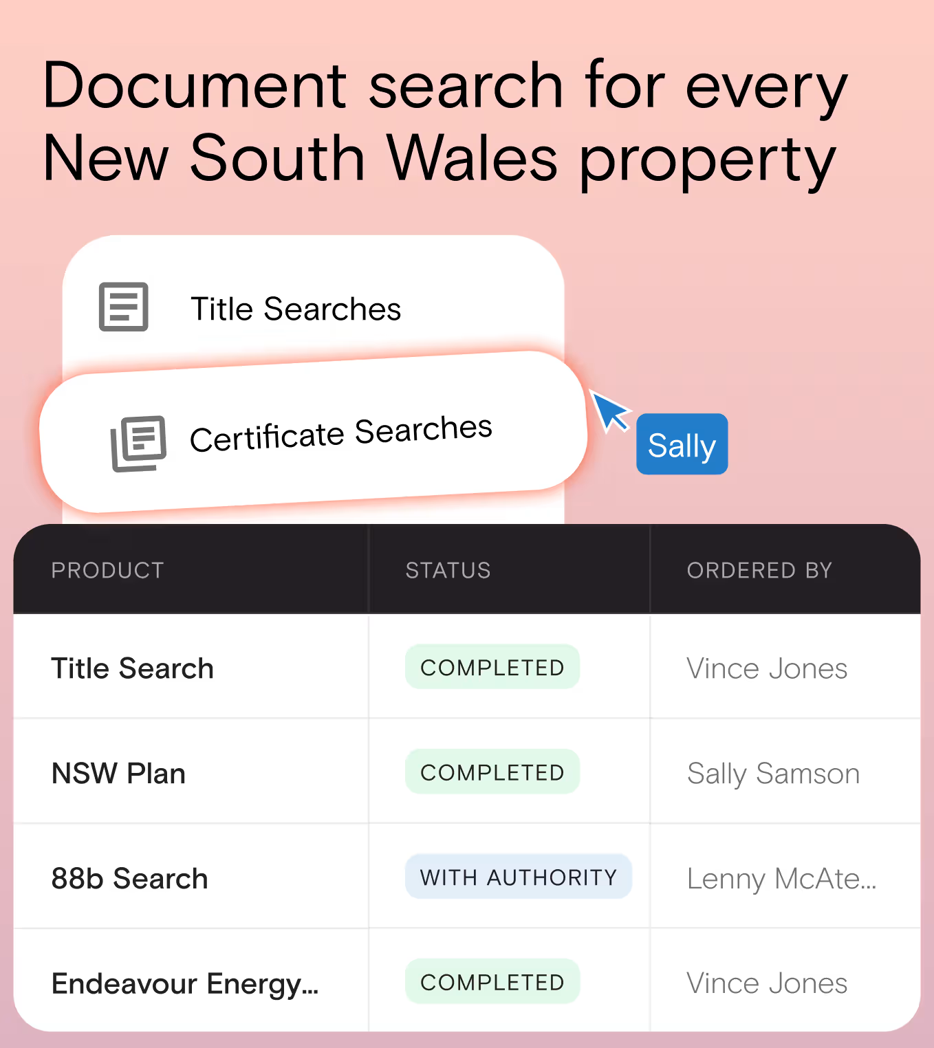
Simply go to our certificate searches page to browse and place your order. You can search by:
- Address
- Council Number
- Crown Description
- Lot/Plan Number
- SPI
- Volume/Folio
Depending on the council, you can place a priority order to receive the certificate earlier than the normal delivery time. To order, you can read this Help Article outlining the steps with screenshots for ease of reference.


Trusted by thousands of businesses every day
"Having access to all this property information in one place is invaluable, from sales data, to planning information and permits. The Landchecker map is very easy to use."
"Clients expect the advice to come immediately so they can make informed decisions on whatever it is they're doing, whether it is an acquisition or development applications or VCAT, Landchecker is that one-stop-shop; a tool that we could use to provide advice we could then give to our clients in a timely fashion."
“Landchecker is the most used and popular online tool for KordaMentha’s real estate team. Its intuitive platform simplifies complex property research, enabling our team to quickly retrieve essential information such as land size, zones and overlays, planning information, and sales history."
"Landchecker has been a gamechanger for InForm - not only in the way in which we are able to gather all accurate information on parcels of land, but also in the way in which we service our clients."
"Landchecker is essential for our business for evaluating development opportunities by offering detailed property insights, High-Resolution Imagery, and zoning data to save time and enable confident decisions."
"Landchecker has provided significant support to our due diligence process, providing efficient searching solution and quick access to key planning data and high-resolution imagery. It’s an essential tool improving the efficiency of our opportunity assessment."
