Flood data coverage and sources
Flood Coverage New South Wales
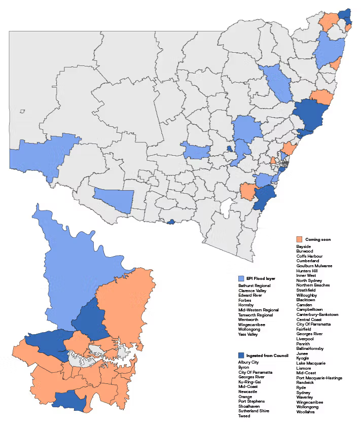
We source Flood data in NSW, from multiple sources and consolidate it into one easy to use interactive map platform. Sources include State Government Dept of Planning and Environment (EPI Flood Layer) and Local Councils. See image below for coverage in NSW.
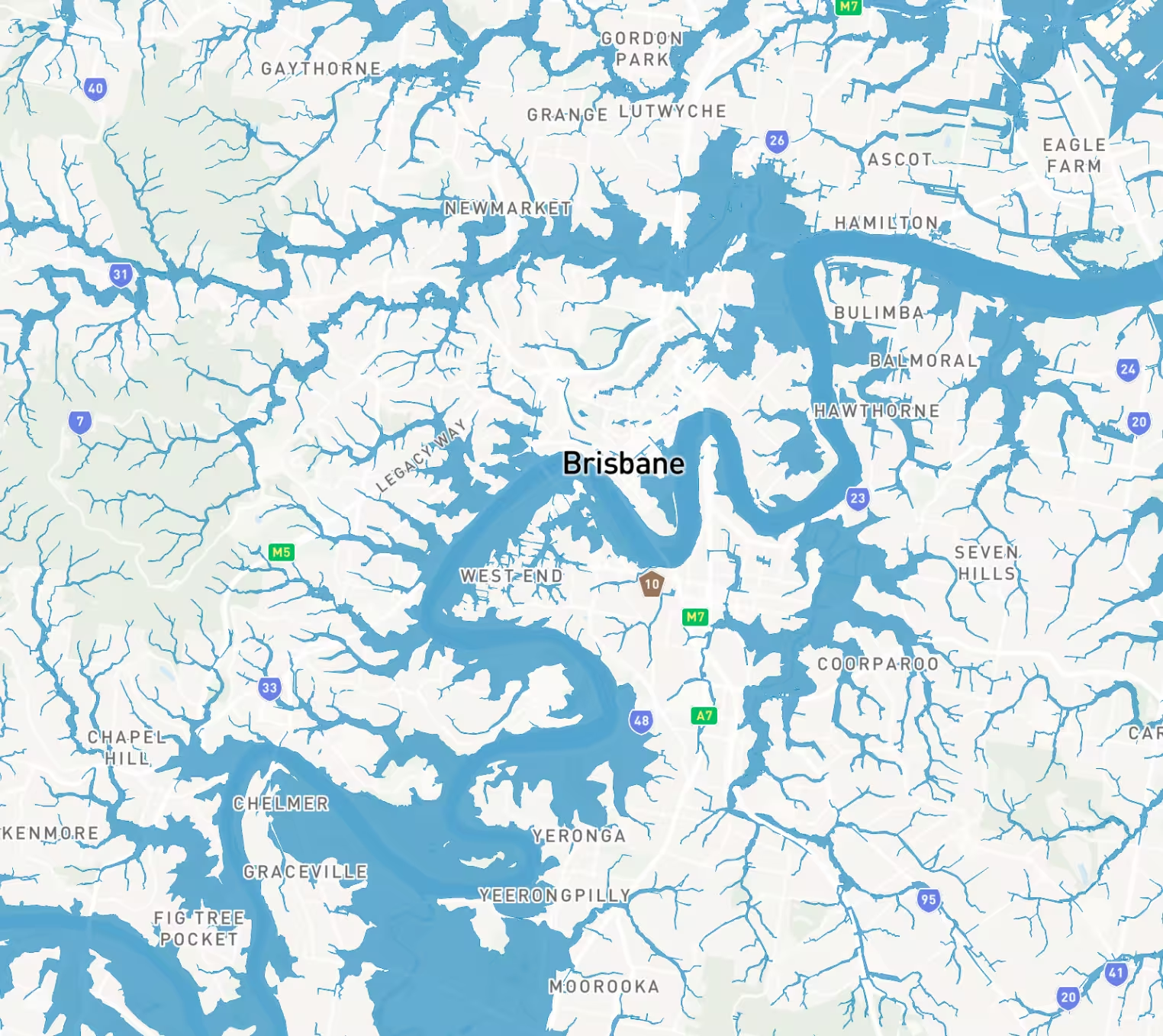
Brisbane City Council
- Brisbane River flood planning area 1-5
- Creek/Waterway flood planning area 1-5
- Overland flow flood planning area
Redlands Council
- Storm Tide Inundation Area
- Flood regulation line
- Drainage constrained land
- 2016 storm tide inundation area
Logan City Council
- Flood assesmant area
- Flood risk area
- Flood investigation
- High flow area
- Isolated islands
- Meadowbrook flood assessment area
Moreton Bay Council
- Priority Development Area
- North Lakes Locality
- Flood planning area boundary
- Flood hazard
- Balance flood planning area


Trusted by thousands of businesses every day
"Having access to all this property information in one place is invaluable, from sales data, to planning information and permits. The Landchecker map is very easy to use."
"Clients expect the advice to come immediately so they can make informed decisions on whatever it is they're doing, whether it is an acquisition or development applications or VCAT, Landchecker is that one-stop-shop; a tool that we could use to provide advice we could then give to our clients in a timely fashion."
“Landchecker is the most used and popular online tool for KordaMentha’s real estate team. Its intuitive platform simplifies complex property research, enabling our team to quickly retrieve essential information such as land size, zones and overlays, planning information, and sales history."
"Landchecker has been a gamechanger for InForm - not only in the way in which we are able to gather all accurate information on parcels of land, but also in the way in which we service our clients."
"Landchecker is essential for our business for evaluating development opportunities by offering detailed property insights, High-Resolution Imagery, and zoning data to save time and enable confident decisions."
"Landchecker has provided significant support to our due diligence process, providing efficient searching solution and quick access to key planning data and high-resolution imagery. It’s an essential tool improving the efficiency of our opportunity assessment."
